
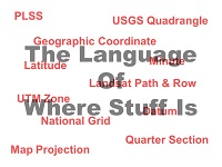
As we grow up, the ability to find our way around develops naturally. Humans have a place in their brains for storing locational information and for retrieving that information when it’s needed. But just because a person knows where something is doesn’t mean he/she can tell another person how to get there. This section of the website looks at some of the formal languages that have been invented for the purpose.
Geographic Coordinate Systems
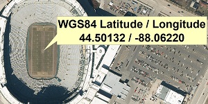
The illustration on the right shows how geographic (latitude/longitude) coordinates might be used to specify the location of a point on the earth’s surface. We’ve found (and in some cases, written) some articles that help learners improve their fluency in this important family of languages. CHECK IT OUT
Projected Coordinate Systems
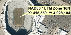
The illustration on the right shows how projected (X and Y) coordinates might be used to specify the location of a point on the earth’s surface. We’ve found (and in some cases, written) some articles that help learners improve their fluency in this important family of languages. CHECK IT OUT
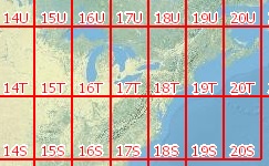
Map Tiling Schemes
The more detail that is shown on a paper map, the larger the map scale needs to be. The larger the scale, the larger the sheet of paper that is needed to show a particular area. To keep paper size manageable, what would otherwise be very large maps are published as multiple small maps called tiles. We’ve found some articles that do a good job of explaining the map tiling schemes commonly encountered in our work. CHECK IT OUT
The National Grid
The current patchwork approach to local and regional mapping has always been a source of logistical screw-ups. Most such screw-ups lead to waste and inconvenience, but in emergency response situations, getting location right is a life or death matter. The USNG is a continuation of earlier attempts to establish a single grid referencing system for the contiguous 48 states. We’ve found (and occasionally, written) some articles on this increasingly relevant topic. CHECK IT OUT
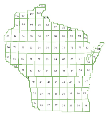
The Public Land Survey System (PLSS)
THE PUBLIC LAND SURVEY SYSTEM (PLSS) – We hack up the earth’s surface for a multitude of informational and legal purposes. How we do the hacking and how we record results depends on the purpose of the subdividing activity. Cadastral mapping, that is mapping done for the purpose of recording land ownership is one of the more specialized instances of the language of where stuff is. Over much of the United States, cadastral mapping is based on the Public Land Survey System or PLSS. CHECK IT OUT
Items Below The Line Are Under Construction – Return to Top of Page