
Why did the elephant wear tennies? Because ninies were too small and elevenies were too big. Why do we use 5-place geographic coordinates for natural resources work? Because 4-place coordinates are generally too imprecise for NR work and 6-place coordinates are indicative of accuracy that we aren’t really achieving.
What Does a Hundred-thousandth of a Degree Look Like?
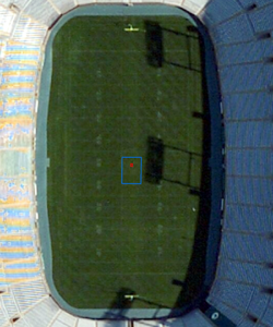
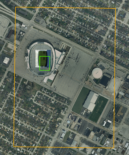
Let’s use the Lambeau Field playing surface to get a sense of the distances and areas involved. We start by hiring a civil engineering firm to determine the “exact” center of the field. The table and photos below illustrate what happens when the “exact” coordinate values are rounded to successively coarser levels of precision.
Precision of Packer “G”
Latitude and Longitude |
Coordinate Values
After Rounding |
Search Area
N-S Distance |
Search Area
Color Code |
|---|---|---|---|
“Exact”
|
44.50132400
-88.06220100 |
n/a
|
n/a
|
Rounded to 5 places
hundred-thousandth degree |
44.50132
-88.06220 |
1.1 meters
|
Red
|
Rounded to 4 places
ten-thousandth degree |
44.5013
-88.0622 |
11.1 meters
|
Blue
|
Rounded to 3 places
thousandth degree |
44.501
-88.062 |
111 meters
|
Green
|
Rounded to 2 places
hundredth degree |
44.50
-88.06 |
1110 meters
|
Orange
|
Comments are closed.